About Sligo Creek
Physical Characteristics
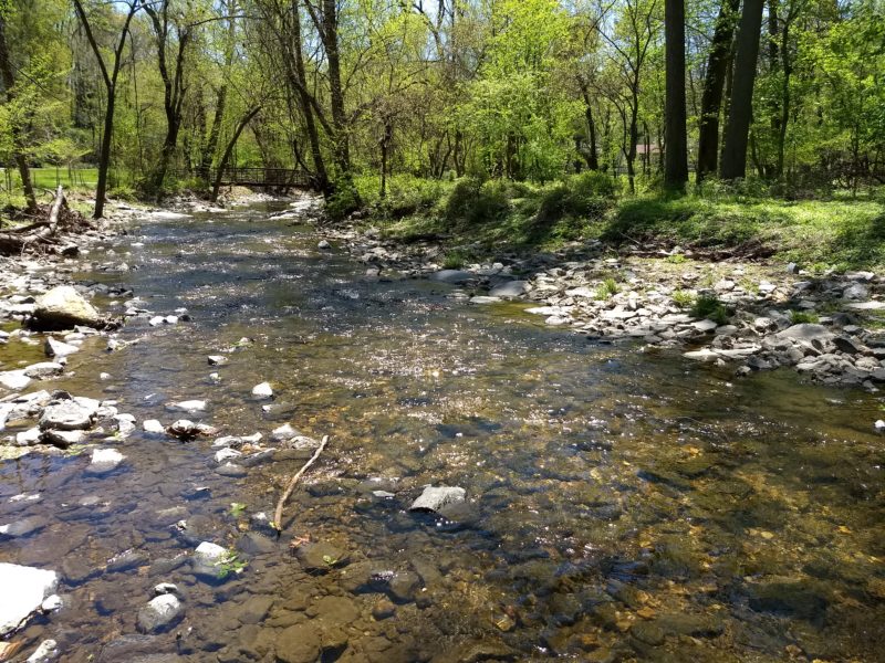
Sligo Creek is a free-flowing tributary of the Northwest Branch of the Anacostia River; the stream joins the Northwest Branch at the western city limits of Hyattsville. The Sligo Creek watershed is generally bound by Arcola Avenue and University Boulevard to the north and east, Queen’s Chapel Road to the southeast, and the District of Columbia and Georgia Avenue to the west. Seventy-five percent of the watershed is in Montgomery County, with 20% and 5% in Prince George’s County and the District of Columbia, respectively.
The three largest land uses by area in the Sligo Creek watershed are residential (75%), forest cover (10%), and commercial (8%). The 2010 population of the Sligo Creek watershed was 81,943 (population density: 7,081/square mile.)
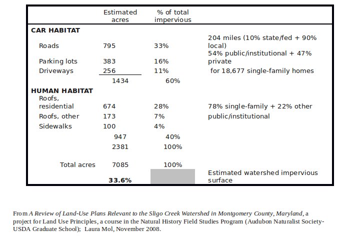
The Sligo Creek watershed is 7,085 acres (11.07 sq. mi.) in size. Approximately 33% of that area is pavement or other impervious surfaces. Elevations range from 450 feet at the sub-watershed divide to 35 feet at the confluence with the Northwest Branch. With an average gradient of 0.72% over 8.3 miles of the mainstem, Sligo Creek flows from its headwaters in the Piedmont physiographic province into the Coastal Plain. The entire lower mainstem, from Riggs Road to the confluence with Northwest Branch, has been channelized.
Biological Characteristics
Sligo Creek is designated a Use I stream by the Maryland Department of the Environment (MDE). The condition of fish and macroinvertebrate populations in Sligo Creek has improved since the completion of the first two phases of habitat restoration in the upper third of the subwatershed. These efforts, which have included controlling stormwater quantity and quality, restoring both tributary and mainstem in-stream habitat, creating wetlands, reforesting, and reintroducing native fish and amphibians have resulted in aquatic habitat rankings of greater than 70% (partially supporting) of reference conditions at three mainstem sampling sites (Cummins and Stribling, 1995.)
Although aquatic biota are correspondingly healthier and more diverse than during previous sampling, mainstem populations remain impacted, scoring no better than 36% (moderately impaired) of reference conditions (Cummins and Stribling, 1995.) Several physical barriers to both resident and anadromous fish movement and migration are present downstream of Riggs Road. These, as well as other barriers in Sligo Creek, have been identified and remain as a restoration challenge for this subwatershed.
Condition Summary
Sligo Creek is one of the most urbanized sub-watersheds within the Maryland portion of the Anacostia watershed. Less than 15% of the total sub-watershed area remains undeveloped, and only 10% of the sub-watershed is in forest cover. The majority of the stream is bordered by a narrow buffer of parkland owned and maintained by the Maryland-National Capital Park and Planning Commission (M-NCPPC). However, only about 35% of the stream miles have an adequate riparian forest buffer (300-foot total width.)
Initial indications are that comprehensive stream restoration efforts in the sub-watershed, as well as fish re-introduction, have been successful in partially restoring the aquatic ecosystem of Sligo Creek (Cummins and Stribling, 1995.) The impaired condition of the aquatic biota that remains is attributable to how recently these projects were completed and the need for additional work. Planned future projects are to include stormwater controls, wetland creation, habitat restoration, and potentially additional fish reintroduction (Galli, 1996.) An overview of restoration work conducted and habitat results was presented to FOSC by Doug Redmond and Daniel Harper in 2004.
Author: Laura Mol, 2008
