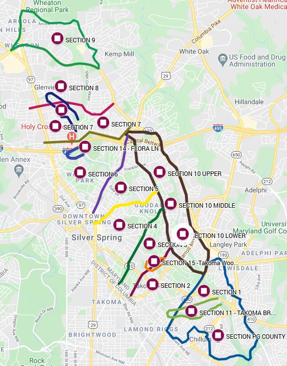
Sligo Creek Section and Topo Maps
Section Maps
|
| Section 1: South of New Hampshire |
| Section 2: New Hampshire to Maple |
| Section 3: Maple to Piney Branch |
| Section 4: Piney Branch to Wayne |
| Section 5: Wayne to Colesville |
| Section 6: Colesville to Forest Glen |
| Section 7: Forest Glen to Dennis |
| Section 8L & 8W: Dennis to Windham Ln |
| Section 9: North of University
Section 10: 10 Upper: North Long Branch to Piney Branch 10 Middle: Piney Branch to Carroll 10 Lower: South of Carroll Section 11: Takoma Branch (incorporated into Section 1) Section 12U & 12L: Wheaton Branch, Upper & Lower (incorporated into Sections 7 & 8) Section 13: Comstock Branch (incorporated into Section 3) Section 14: Flora Lane (incorporated into Section 6) Section 15: Takoma Woods (incorporated into Section 3) |
This section map shows section boundaries. See the Trail Guide of Sligo Creek Stream Valley for details about the trail and trail features in each section.


